Oadby Grange
Oadby, Leicestershire


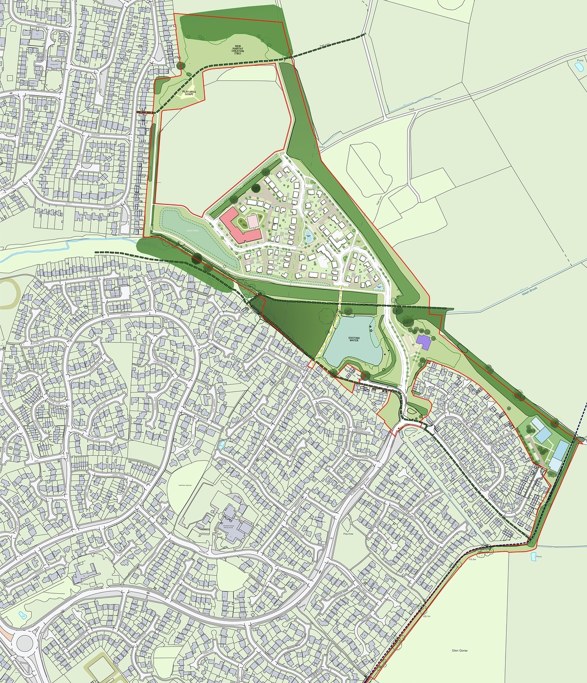
The site borders the Eastern edge of the town Oadby; the Western edge of the site is defined by the existing built environment.
Currently the site extends to approximately 17.948ha, the main developable area comprises of a pastoral field and a narrow parcel of land that adjoins the existing development and separates the country park with dense vegetation.
The existing settlement edge of Oadby and the rear gardens of properties along Windrush Drive define the western boundary. Existing trees and hedgerows define the Northern and Eastern edges of the site and form part of Oadby Grange Country Park.
Oadby Grange Farm and The Wilderness are the only other built forms that lie within 800m East of the site. The immediate landform of the site is simple, the contours rise north from the site and there is a gentle slope west allowing for views towards the town.
The roads that lead into the site are Florence Wragg Way, Pipistrelle Way, and Devonia Way. There is a footpath located North West of the site.
The local amenities located in proximity to the site include Woodland Grange Primary School, St Pauls Church, The Co-op and a health centre, these are all walking distance away.
Bus stops including Hamble Road, Derwent Walk, Hursley Close, Meynell Close and Poachers Place are all within walking distance and provide public transport to other required amenities.
Oadby, Leicestershire